By REX ROBLES
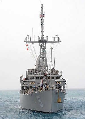
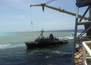
 LAST week, the US Navy released the result of its investigation on the Jan. 17, 2013 grounding of USS Guardian in Tubbataha Reef in the Sulu Sea, pinning the blame on “lack of leadership” but praising the “heroic efforts of the crew to save their ship.”
One reason why the report seems superficial and incomplete is that it failed to attach true copies of essential navigational documents.
As a rule, whenever a Navy ship leaves port for any destination, the path or course it is to take to reach its destination is set down beforehand on a maritime map, commonly referred to as a chart. This is required for those navigating over water and all Navy vessels, except small boats on short trips along a coastline or a river, must perform this basic task.
The charted course is an official record of a ship’s movement and, together with the Quartermaster’s logbook that records the actual position, heading and speed of the ship at any time, will form an important part of any investigation involving that ship and its crew.
The course a voyage will take is reviewed and approved by the ship’s captain before it is implemented. Any subsequent radical deviation from the charted course will, likewise, have to be approved by him. The record of the ship’s planned movement together with the actual path to its destination is also recorded electronically, which is convenient and easy to retrieve.
When our government failed to assert its sovereign right to conduct an independent investigation of the incident, we effectively barred ourselves from gaining access to certain necessary records surrounding the incident. These records would have thrown light on many questions that the report seems to have glossed over.
According to the report, the admitted destination of the ship was Timor-Leste. There was no mention of any stopover along the way, much less any intention to enter, with permission, the highly restricted and internationally protected waters of Tubbataha. Indeed, from a navigator’s point of view, in order for the grounding to take place, the Guardian would have to stray way beyond the usual course followed by ocean-going vessels traversing the area.
How would an “error,” attributed by the report to faulty digital maps, lead the Guardian deep into restricted waters of the Sulu Sea? Apparently, this will have to remain a mystery since the Philippine government has already inhibited itself from investigating the incident.
The unanswered questions go beyond what the report covers, which seems to confine itself only to questions of adequate leadership, navigational skill and accuracy of digital nautical charts (DnC).
Okay then, let’s just ask a couple of questions that are among several that obviously need to be asked: Was it part of the mission of the Guardian to transit through restricted waters? If so, what clearance did it possess, and at what level was it granted?
The reference to “heroic efforts of the crew to save the ship” merely underlines the studious avoidance by the report from discussing the critical questions involved.
Finally, it would seem specious, at the very least, for the report to mention faulty digital maps at all. Navigational errors arising from the use of digital charts, which are based on multi-satellite projections, could not be in the order of “error” committed by the Guardian, which found itself scores of miles off course. In language surely clear to every maritime navigator, one could expect an error of “seconds to a degree,” which translates to only several hundred feet, at the most.
But the all these hanging questions will remain in the air due to our own fault. In our dealings with China, with Malaysia, and more recently with Taiwan, we have adopted a posture that many would consider timorous and tentative, but which our leaders apparently regard as subtle, sophisticated and effective.
(The author is a retired Philippine Navy commodore and currently head of RCR Consultancy, a security risk management outfit. )

