Senior Associate Justice Antonio T. Carpio. File photo by Daniel Abunales.
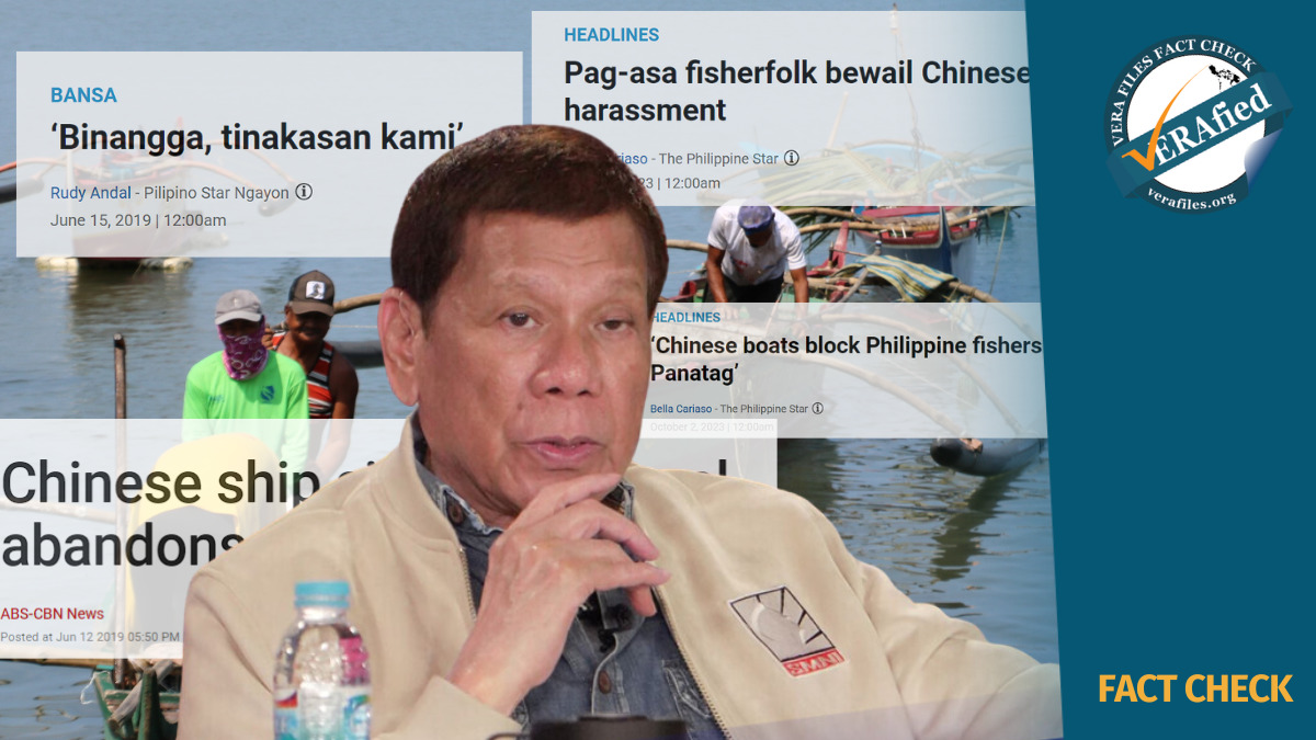
Supreme Court Senior Associate Justice Antonio T. Carpio reminded Sunday President Duterte of his “constitutional duty”to the Filipino people to defend the country’s national territory and suggested to him four ways he can do it as regards the reported China’s plans to set up an environmental monitoring station in Scarborough Shoal.
This is after the President said he cannot stop China from what it is doing unless he declared war against the behemoth neighbour which he is not willing to do.
In a press conference at the Davao City International Airport, Duterte was asked about a news report that China is planning to build a radar station in Scarborough shoal, 124 nautical miles from Zambales in Luzon.
Duterte replied: “Well, we cannot stop China from doing his thing. Hindi nga napara ng Amerikano (The Americans were not able to stop [them])”
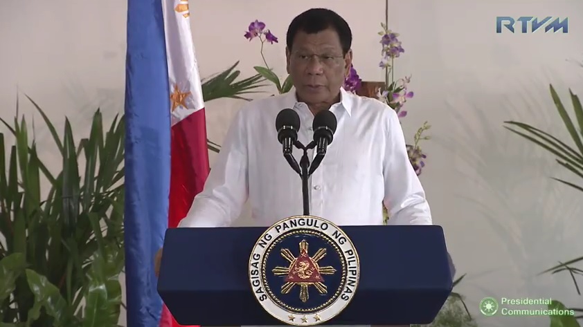
President Duterte holds a press conference at the Davao International Airport before he leaves for Myanmar, March 19, 2017.
Duterte further said: “So what do you want me to do? What do you want? Sir, ano bang gawin ko? Declare war against China?
“I can but we’ll all lose all our military and policemen tomorrow, and we are a destroyed nation. And we cannot assert even a single sentence of any provision that we signed,” the usually-tough-talking president said.
Carpio, who has worked closely with the Philippine legal team in the case against China in the Arbitral Court, reminded Duterte that, “The President is the Commander-in-Chief of the Armed Forces which are expressly tasked by the Constitution to defend the national territory.”
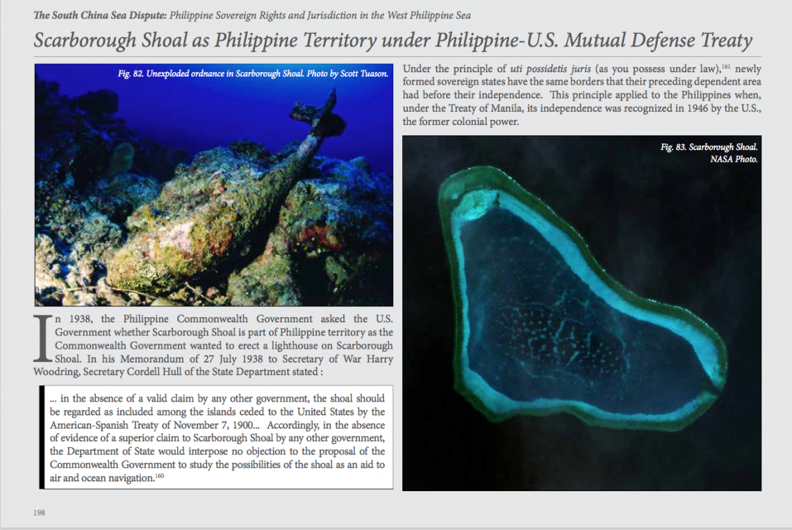
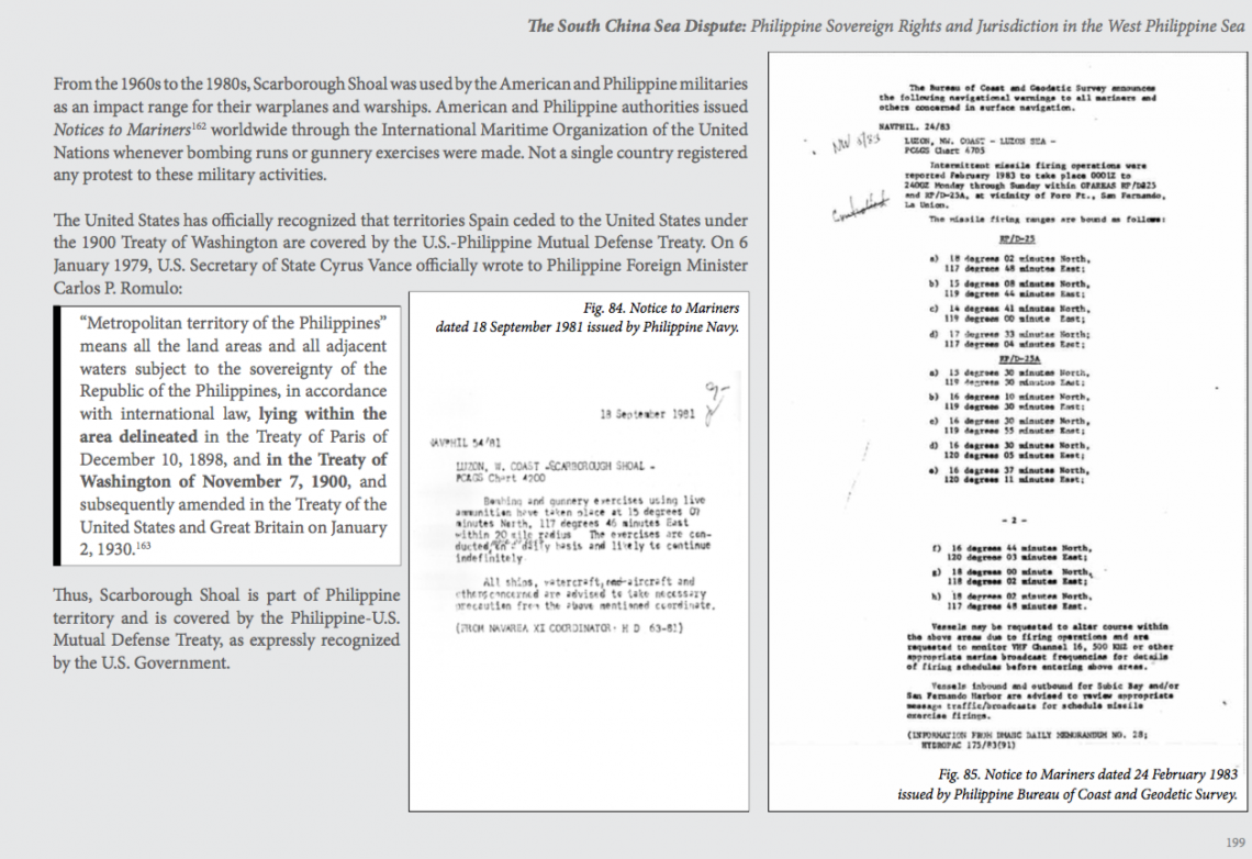
“Under RA No. 9522, Scarborough Shoal is part of Philippine national territory,” he said.
Since the Philippines is no match to China militarily, Carpio said the President can fulfill his constitutional duty by doing any, some or all of the following:
1.File a strong formal protest against the Chinese building activity.This is the least that the President should do. This is what the Vietnamese did recently when China sent cruise tours to the disputed Paracels.
2.Send the Philippine Navy to patrol Scarborough Shoal.If the Chinese attack Philippine navy vessels,then invoke the Phil-U.S. Mutual defense Treaty which covers any armed attack on Philippine navy vessels operating in the South China Sea.
3.Ask the United States to declare that Scarborough Shoal is part of Philippine territory for purposes of the Phil-US Mutual Defense Treaty since the shoal has been part ofPhilippine territory even during the American colonial period The U.S. has declared the Senkakus as part of Japanese territory for purposes of the US-Japan mutual defense treaty.
4.Avoid any act, statement or declaration that expressly or impliedly waives Philippine sovereignty to anyPhilippine territory in the West Philippine Sea.This will preserve for future generations of Filipinos theirnational patrimony in the West Philippine Sea.
Any statement that the Philippines cannot stop China from building on Scarborough Shoal actually encourages China to build on Scarborough Shoal.
Reuters reported last Friday about a news item in a Chinese language Hainan Dailyquoting Xiao Jie, mayor of Sansha City, about plans to begin preparatory work this year to build environmental monitoring stations on a number of islands, including Scarborough Shoal.
Sansha city was established only in June 2012 in the province of Hainan. News reports about the creation of Sansha city said it covers “Xisha, Zhongsha and Nansha islands and their surrounding waters in the South China Sea.”
The Philippines and Vietnam had protested the inclusion of parts of their territory in the new city.
In its June 2012 note verbale, the DFAsaid the “the establishment of Sansha city as the extent of the jurisdiction of the city violates Philippine territorial sovereignty over the Kalayaan Group and Bajo de Masinloc”
The note verbale also said Sansha City “infringes on Philippine sovereign rights over the waters and continental shelves of the West Philippine Sea.”
China, as expected ignored the protests. Last year, there were already reports about the building of “waste water treatment facilities, garbage collection and transfer stations, and marine environmental monitoring stations” in islands under Sansha City but it did not mention Huangyan , the Chinese name for Scarborough Shoal, also known as Panatag and Bajo de Masinloc.
A Chinese source said, in the May 13 Hainan Daily report, the mayorsaid, “We would continuously push through the fundamental pre-works of the environment-monitoring station for the mentioned three islands. “
That was enough for Carpio to sound the alarm bells citing China’s track record in converting science-related installations into military facilities.
“In 1987, the Chinese erected a radar weather station on Fiery Cross Reef (an outcrop in Spratlys just a meter above water) ostensibly to help UNESCO’s global oceanic survey. In 2014-15, the Chinese turned the weather station into a 270-hectare military air-naval base.
“Now it’s the turn of Scarborough Shoal. China will install an environmental monitoring station (a.k.a. radar station) on Scarborough Shoal. A radar station on Scarborough Shoal will immediately complete China’s radar coverage of the entire South China Sea. China can then impose an ADIZ or air defense identification zone in the South China Sea.”
Carpio warned “China will use its HQ-9 surface to air missiles to enforce the ADIZ. These missiles are now installed on Woody Island in the Paracels. China also just completed building on Subi Reef, Mischief Reef and Fiery Cross Reef concrete hexagonal structures, with retractable roofs, to house HQ-9 missile batteries.
“The Chinese will of course also use these same military installations to enforce the 9-dashed lines as China’s national boundaries in the South China Sea. That means China will grab 80 percent of Philippine EEZ and 100 percent of Philippine extended continental shelf in the West Philippine Sea.”
Carpio said “These developments call for a national debate, and consensus, on how the nation should proceed with its bilateral relations with China.”
These developments also reminds us of the paper,“Geopoliticsof Scarborough Shoal” written by Francois-Xavier Bonnet of the Bangkok-based Research Institute on Contemporary Southeast Asia (IRASEC) which explains the importance of Huangyan Island in the bigger and long-term objective of China.
Bonnet said Huangyan Island/Bajo de Masinclocis crucial to China’sclaim over the Zhongsah Qundao islands which is vital in its controversial nine-dash line map that puts 90 percent of the whole South China under Chinese jurisdiction.
The map is called “nine-dash line” or “nine-dotted line” because it shows a series of nine dashes or dotted lines forming a ring around the South China Sea area, which China claims is part of its territory. The area includes the Spratlys group and Bajo de Masinloc.
Bonnet explained that, “The Zhongsha Qundao is composed of Macclesfield Bank, Truro Shoal, Saint Esprit Shoal. Dreyer Shoal and Scarborough Shoal. All these banks and shoals, except for Scarborough Shoal, are under several meters of water even during low tide. Chinese policymakers know too well that without Huangyan island, the chance of their ownership over Zhongsha Qundao recognized is nil.”
Bonnet said, “The stakes are high. If China loses Huangyan/Scarborough, it will lose Zhongsha Qundao, which could be divided by the EEZs of the nenighboring countries or placed under the regime of the high seas. By consequence, China’s entire claim to the South China Sea supported by the U-shape line would be moot and academic.”

The importance of Zhongsha Qundao which includes Scarborough shoal is re-affirmed in thestatement of China’s foreign ministry released immediately after the decision of the Arbitral Court on the Philippine case against China in July 2012.
The statement started with “ China’s Nanhai Zhudao (the South China Sea Islands) consist of Dongsha Qundao (the Dongsha Islands), Xisha Qundao (the Xisha Islands), Zhongsha Qundao (the Zhongsha Islands) and Nansha Qundao (the Nansha Islands). The activities of the Chinese people in the South China Sea date back to over 2,000 years ago. China is the first to have discovered, named, and explored and exploited Nanhai Zhudao and relevant waters, and the first to have exercised sovereignty and jurisdiction over them continuously, peacefully and effectively, thus establishing territorial sovereignty and relevant rights and interests in the South China Sea.”