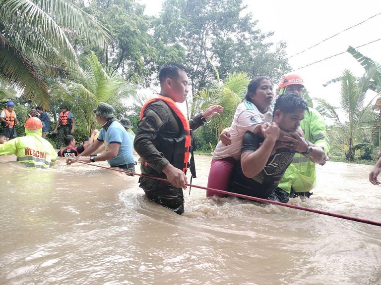
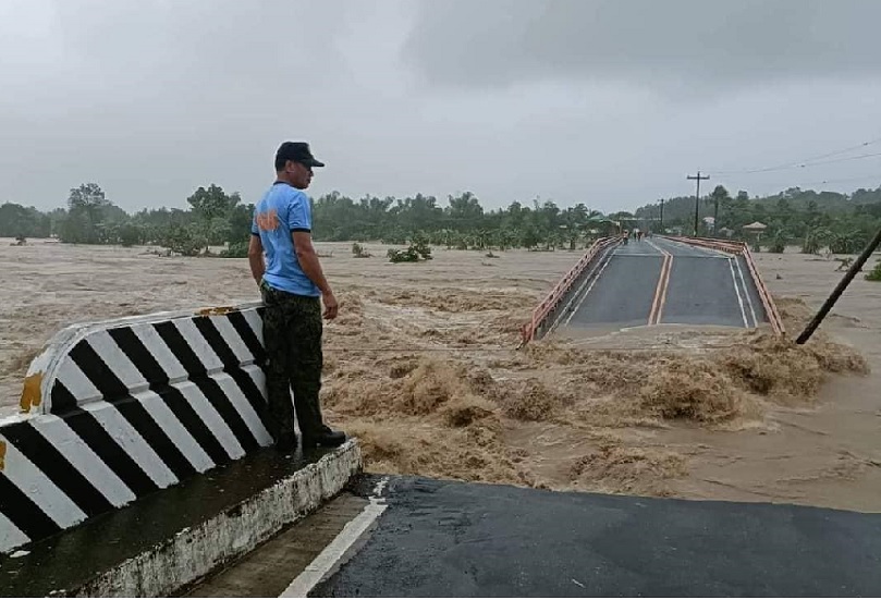
Super Typhoon Pablo (international code name Bopha) hit Davao Oriental and Davao de Oro provinces on December 3, 2012. It was Category 5 and was the strongest tropical cyclone on record to ever hit Mindanao at 280 km/hr. It surpassed Severe Tropical Storm Sendong (Washi) that hit northern Mindanao a year earlier on December 16, 2011.
Re-echoed as the residents coped with the massive destruction was a common discourse: “Mindanao is not on the typhoon belt.” London’s Telegraph reported that even the executive director of the National Disaster Risk Reduction and Management Council in Manila commented that, “storms rarely hit this area.” One Mindanao official issued a gullible statement: “Typhoons in Mindanao are the new normal.”
None of those are true. All of those have created a myth that only provides a false sense of security vis-à-vis typhoons. Ironically, available historical literature can easily debunk the mystification. In fact, world-class weather forecasting began in the Philippines from what is known today as the Manila Observatory, an institution presently attached to the Ateneo de Manila University.
The Jesuit scholastic and physicist Francisco Colina started the seminal effort at weather forecasting from modest homemade instruments in the abandoned pigeon house at the roof deck of the Jesuit residence in Intramuros. It later evolved as the Observatorio Meteorologico of the Ateneo Municipal de Manila with Federico Faura as its first director.
In 1879, it began issuing typhoon warnings, and then earthquake observations in 1880. The effort paid off. In 1884, the Spanish government issued a Royal Decree signed by King Alfonso XII formally entrusting it as the official Philippine institution for weather forecasting, and was renamed El Observatorio de Manila. That was the forerunner of today’s elongatedly named PAGASA.
In 1886, Faura developed the typhoon barometer that was immediately used by navigators of the Philippine seas and of the South China Sea that became universally known as the Faura Aneroid. The invention prompted Japan to exchange weather observations with the Philippines in 1890.
Faura’s fellow Jesuit Jose Maria Algué succeeded him as director in 1897. That was also the year that Algué improved on the Faura Aneroid, which he named the barocyclonometer. In November 1898, Admiral George Dewey, the victor of the Battle of Manila Bay, called Algué on short notice to the bridge of his flagship the Olympia. In January 1899, the Schurmann Commission appointed Algué director of the Weather Bureau with the existing Observatorio de Manila as the central office.
The US weather bureau utilized Algué’s barocyclonometer to the hilt. In 1912, the New York Times reported that his barocyclonometer was applied to the Atlantic Ocean and was ordered for naval use by the US Secretary of the Navy for all its Atlantic naval stations. The United States Weather Bureau in 1919 also employed Algué’s device at Fort Myers on the west coast of Florida as a special station to track hurricanes in the Caribbean Sea and in the Gulf of Mexico.
Back in the Philippines, at the end of 1923, Algué had altogether assembled a network of 159 weather stations all over the Philippines. By 1925, he had established ninety volunteer stations manned by local townsfolk. So world renowned was he that James Francis Warren, professor of history and Southeast Asian Studies at Murdoch University, Australian National University, Yale and Kyoto University dubbed Algué, who was honorary member of London’s Royal Meteorological Society, as the “Scientific Superman.”
This rather long story is an apt prelude to what came after Algué. Another Spanish Jesuit, US-educated meteorologist named Miguel Selga succeeded him in 1926. In 1935, Selga published the “Charts of Remarkable Typhoons in the Philippines, 1902-1934,” that included the astoundingly researched “Catalogue of Typhoons, 1348-1934.”
This is where proponents of “typhoons in Mindanao are the new normal” must read to gain factual traction. Let us be educated from the following few snippets of Selga’s tome.
November 21, 1846: A strong typhoon raged over Visayas from northern Mindanao to Mindoro. The floods in Cagayan, Camiguin and Dapitan were extraordinary.
November 7-12, 1865: Samar and Leyte experienced a heavy typhoon. Many houses were destroyed. The crop of Occidental Samar, about to be harvested, was a total loss. The same baguio hit the province of Pangasinan; most of the houses were unroofed in Urbiztondo, Mangatarem and Manaoag. The same typhoon was responsible for heavy floods in the Zamboanga district, Mindanao. (N.B. The recent Typhoon Paeng affecting a wide swath of the archipelago was nothing new)
December 25, 1874: At dawn of Christmas of 1874, a terrible storm was felt in Cagayan de Misamis (N.B. Cagayan de Oro today), with rain and strong winds from the southeast. The storm destroyed 61 houses in Mambajao, and unroofed the church, convent, and other edifices. In Mahinog, the tribunal, convent, and 29 houses were damaged. In Guinsiliban, the convent, school, and 54 houses were blown down. In the whole province of Misamis, the abaca, corn, and palay plantations, as well as the herds of livestock and edifices, received considerable damages. In Cebu, the storm was felt on the afternoon of the 26th, accompanied by fierce gusts from the west, which lasted six hours, and destroyed a great part of the houses made of light materials, as well as the trees. The rivers overfloooded their banks, and various cascos sank in the bay.
November 25-27, 1876: From the 25th to the 27th of November, 1876, a terrible hurricane, unsurpassed in fury by other similar phenomena for 20 years past, scattered desolation and death in the islands of Mindanao and Visayas. The islands most affected Bohol, Cebu, Panay, Negros, Calamianes, and the whole northern part of the big island of Mindanao, reaching as far as Paragua. More than 150 persons from distant parts of the Archipelago were the unfortunate victims of this doleful storm.
May 3-14, 1891: A typhoon from parallel 60 N, E of southern Mindanao, crossed Davao, Cotabato, N Zamboanga and Palawan, recurved near Paracels to the NE and passed into the Pacific through the Bashi Channel.
August 19-30, 1892: Coming from S of the Palaos this typhoon crossed Mindanao from Baganga to Dapitan, proceeded to N Palawan and, inclining in the China Sea more to the NW, reached the Continent N of Hainan.
October 23-28, 1894: Starting from ESE of Palau, a depression reached Mindanao, crossed Davao, Cotabato and the Zamboanga peninsula and continued to the China Sea across S Palawan.
December 16-23, 1894: Starting from a point ENE of Palau, a depression continued to Davao, passed between Zamboanga and Basilan and proceeded to the China Sea through the Balabac Pass.
October 29-31, 1904: A typhoon entered the Archipelago south of Cape San Agustin, passed close to Sarangani Island, crossed the Jolo group and entered the China Sea.
November 28 – December 6, 1910: A typhoon formed over the southern part of Western Carolines, moved W close to the south of Palau, passed very near Davao and Mati, then to the N of Cotabato in a NW direction; it turned again westward, crossing southern Palawan, and moving WNW over the China Sea, entered Indochina near Nhatrang. The destruction caused by the violent hurricane in Davao and Mati was considerable. Zamboanga suffered great losses due to extraordinary inundations. The steamer Suisang experienced heavy seas and violent winds. The barometric minimum at Davao was 743.28 mm.
January 16-24, 1916: It originated SSW of Guam, moved W and entered very close to or over Cateel. Then it remained stationary and gradually filled up within Mindanao. The floods and subsequent losses that occurred in Mindanao were very heavy; plantations were washed away, bridges destroyed and houses carried away, resulting in loss of life in many cases. Barometric minimum at Cateel was 747 mm. Many rivers of Mindanao rose rapidly over 6, 7, to 8 meters and caused great destruction to houses, livestock, crops and roads. Agusan Province suffered the most, the rivers rising 7 to 8 meters so much so that the region from Ebro and Los Martires and Veruela and Gracia was transformed into a great lake, where only the tops of the trees were visible.
Notice that the later parts were mostly based on barometric readings of the time, most probably from Algué’s barocyclonometer. But here’s what we also fail to input in our understanding of typhoons that Selga explains:
Mindanao typhoons occur late in the year to early the following year – “owing to the considerable force obtained by the northeasterly winds prevailing during this time of the year,” Selga writes. The northeast monsoon, commonly known in the Philippines as the amihan, blows from September or October to May or June. Selga’s typhoon maps show that during this period, typhoons are down in the southern Philippines; otherwise they are up in the north during the southwest monsoon or habagat. This is a basic consideration that somehow escapes our native understanding of typhoons.
The views in this column are those of the author and do not necessarily reflect the views of VERA Files.

