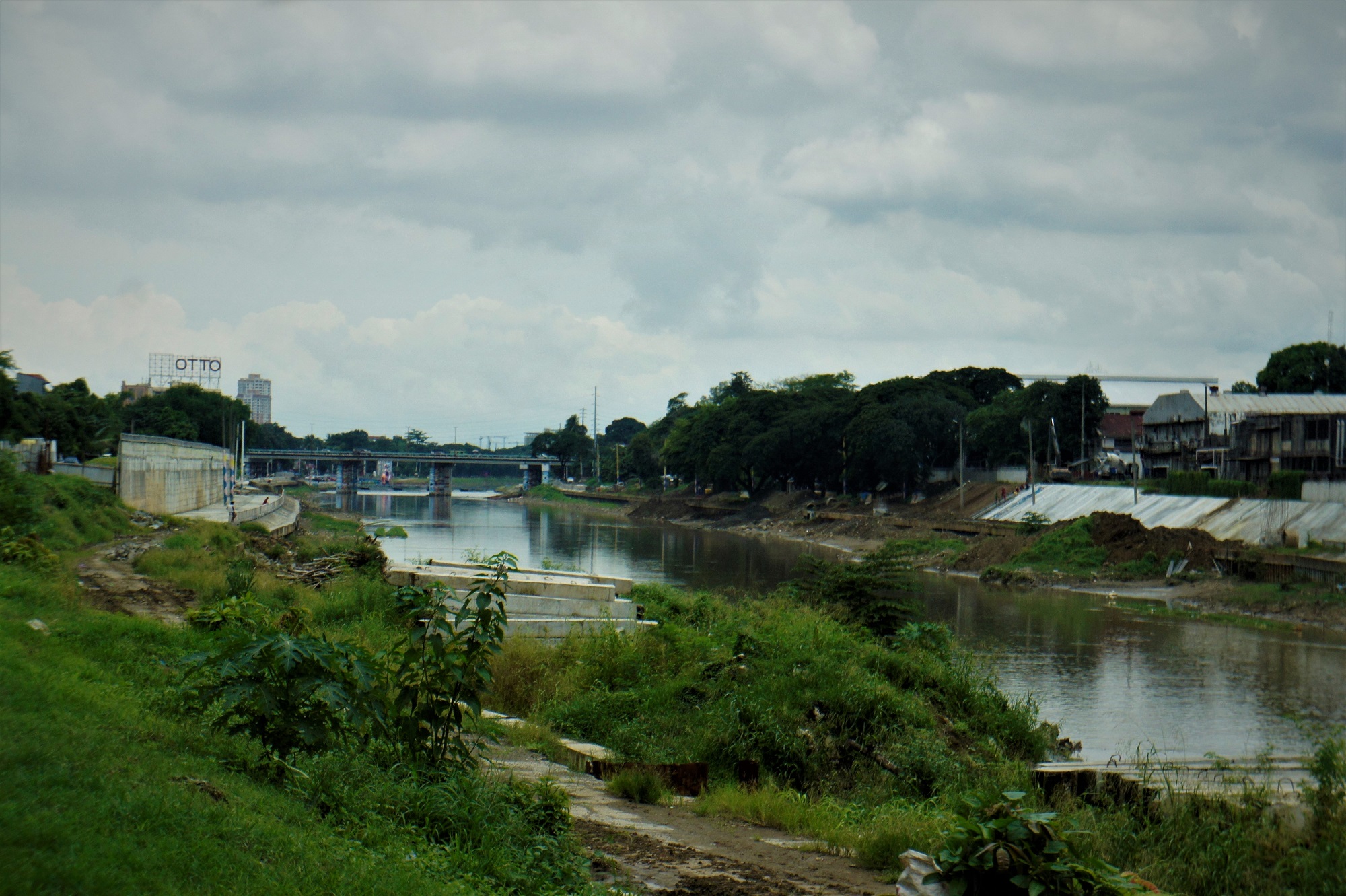
THE disappearance of 21 kilometers of rivers in Metro Manila and the constriction of existing ones have contributed to the worst flooding ever seen in the area during storm “Ondoy,” scientists said on Monday.
During a briefing on climate change held at the Rockwell Club, the scientists also said it is not only the informal settlers and factories that have encroached illegally on river banks. Even the government—notably Malacanang—has been guilty of occupying areas that should serve as channels for floodwaters.
A portion of the Presidential Security Group compound housing the Mabini Shrine used to jut out into the Pasig River, thereby narrowing that portion of the river. The Metro Manila Development Authority, however, has asked to reclaim the area in order to widen the Pasig River. The shrine has also been transferred.
The briefing was conducted by Antonia Yulo Loyzaga and Dr. Gemma Narisma of the Manila Observatory, Dr. Fernando Siringan of the University of the Philippines Marine Science Institute and Dr. Alfredo Mahar Lagmay of the University of the Philippines National Institute of Geological Sciences.
Showing maps where rivers used to run across the metropolis and places in Luzon such as Guagua, Pampanga, Siringan said waterways have become narrower—and in certain areas ceased to exist—because of the encroachment of structures and the setting up of fishponds.
He added that while it is true that sea levels have been rising globally, human neglect and activities have also contributed greatly to serious flooding. In the metropolis, he noted that the drainage system was “insufficient” and “century-old.”
Land subsidence—or the sinking of the land because of overuse of groundwater—has likewise caused flooding. Rapid and continuous pumping of groundwater has led to the compaction of the soil because the supply cannot be replenished quickly enough.
Citing earlier studies, Siringan said from 1978 to 2000, Malabon and Caloocan have sunk by 1.5 meters; Manila by 0.96 meters; Quezon City by 0.76 meters; and Makati by 0.57 meters.
He cautioned against recharging the aquifers—the rocks that contain groundwater—saying to do so could cause tremors and activate existing faults.
To help prevent the recurrence of the floods that hit Metro Manila during Ondoy, Siringan said the government should increase the number of channels through which floodwaters can flow.
This means widening the Pasig and Taguig rivers and reviving other rivers in the Taguig Delta Plain. It could also modify the Napindan structure.
Commenting on the flooding of areas in Marikina, Lagmay said most of this happened in the Marikina River system.
He disputed the impression created by reports that the entire city came underwater at the height of Ondoy. He said most of the flooded areas were leg-deep even as some places remained safe from flood waters.
On the public perception that the SM mall beside the Marikina River had caused the flooding in the area, Lagmay said the area was already vulnerable to floods even before the mall was built. Elevated by pillars, the shopping center is only meters away from the river.