Romer Guimba was driving his jeepney along the Talisay-Tanauan road just past the Total Gas Station en route to the Talaga Public Elementary School to pick up his regular student passengers when the Magnitude 5.9 earthquake struck.
“Hindi ko po nahalata nung una, pero nakakatakot kasi parang nawala sa lugar ang sasakyan ko,” (I didn’t notice it at first then it got was scary, I could not seem to control my vehicle) Guimba said.
He immediately pulled over. After 10 seconds, the earthquake was gone.
Laden with 8 passengers who panicked when the jeepney started pulling sideways made it more difficult to react.
“Parang flat po ang sasakyan. Ang bigat pihitin ng manibela,” (The vehicle felt like it had flat tires, it was difficult to maneuver),” adds Guimba.
Driving a 2016 sports utility vehicle with a jetski in tow, Jules Gamboa of Laguna was on his way to Eagle Point beach on the Balayan Bay side of Mabini town by Bagalangit—the epicenter of the 5.6 earthquake of April 4.
“The first thing I noticed was that the trailer was not centered with the car,” said Gamboa, a jet ski enthusiast.
His first instinct was to pull over. The van in front seemed to be swaying side to side. He could see the lampposts swaying and the electric wires overhead flapping. After the brief earthquake, he noticed most of the vehicles along Mabini National Road stopped by the roadside — everyone was caught by surprise.
It was a different story for Guillermo Cabotaje, a former trailer driver on the Mabini Circumferential Road. He was driving a small van ferrying tourists to one of the many dive sites around the coastal town. The truck in front of him suddenly stopped, causing him to brake urgently.
“Nakita kong sumasayaw ang mga poste ng kuryente sa kanan, kaya’t doon po ako tumigil sa kaliwa, tabing dagat, malayo sa poste,” (I saw the electric poles swaying so I stopped on the left side of the road near the coast, away from the posts) Cabotaje narrated.
Cabotaje, 58, was a driver for a vegetable farmers cooperative in Baguio. On July 16, 1990, he was at Camp 3 of Kennon Road heading to Cabanatuan when the “Big One” of that decade struck. He narrated how that eight-second earthquake seemed like 10 minutes.
He saw portions of the road buckle. Landslides began blocking the road. But instead of pulling over, he rushed down the mountain road that was literally crumbling beneath him. He could not go back up Kennon, even as he feared for the safety of his family who then lived in Loakan.
He was driving a full-size six-wheel truck filled with vegetables.
“Overloaded nga po kami madalas at puno ng hangin yun gulong,” he relates, stating that looking back now it seemed the vehicle itself was dangerous to drive with a tall cargo bay and overinflated tires to carry the extra payload.
Like in the case of Guimba in the first story, his passengers all panicked during the earthquake.
Once the earthquake stopped, the passengers rushed out of the van but a few minutes later another earthquake happened.
In a span of less than a week, nearly 10 earthquakes with Magnitude 4 and up have hit the Calabarzon region. Three of the strongest ones happened from April 4 in Puerto Galera to Batangas last April 8 and back to Mindoro on April 9.
Shake maps from the United States Geological Survey (USGS) show the strongest of the quakes hit inland in Tanauan, Batangas but the most felt was a tectonic shaker of Magnitude 5.5 in the coastal resort town of Mabini, also in Batangas.
The severity of an earthquake determines how a driver reacts to it. The “panic level” changes from “I didn’t feel it” to “what the hell is going on!” And drivers like Mr. Cabojate says that once the earth is moving, fear takes over your senses.
Less control and the potential for road crashes are the first result of driving panic. But panic and surprise are also the top reasons drivers instinctively pull off the road and park the car. In the stories of the three drivers, only one, Cabajote took stock of his surroundings. The rest simply pulled over—one even below an electric post with swaying wires.
All the drivers and their passengers stayed in the car until the ground stopped moving. This self-imposed “all clear” call is a function of self-preservation. It was also observed that in one instance, the passengers who disembark after a “coast is clear” declaration scrambled back to the vehicle at the first sign of another tremor.
It is a good idea to stay in the vehicle while a visual assessment of the surroundings is done. It’s also a good time to recap what just happened by gathering some information. Listening to the radio and reading social media feeds or texting friends is best, instead of making a phone call. Phone calls congest the lines since voice uses up more bandwidth than data or SMS.
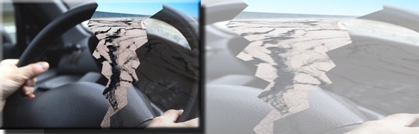
Our beautiful country is filled with many infrastructure components that usually become unsafe or rickety after a natural disaster. Watch out for collapsed bridges, broken pavement, overhangs, fallen power lines, cracks in tunnels or flyovers, steep roads (which have a huge potential for liquefaction) or landslides.
Driving after an earthquake is a more horrible experience than driving during one.
Before starting to drive, listen to the radio for reports, use technology to get your way around. Call Waze for road conditions. Check Facebook or Twitter for earthquake related feeds. Assess the condition of your route, and visually confirm it.
Take photos and share it on official social media feeds of the local government you are in or the Department of Public Works and Highways (DPWH), Department of Transporation (DOTr) or the Land Transportation Office (LTO).
If the roads look drivable, proceed with caution. There could be a lot of debris which could do tire or under chassis damage.
This story, first published on Malaya Business Insight, was produced under the Bloomberg Initiative Global Road Safety Media Fellowship implemented by the World Health Organization, Department of Transportation and VERA Files.