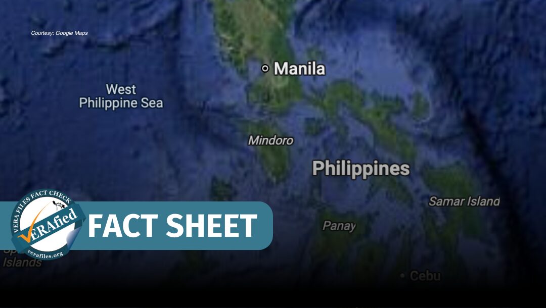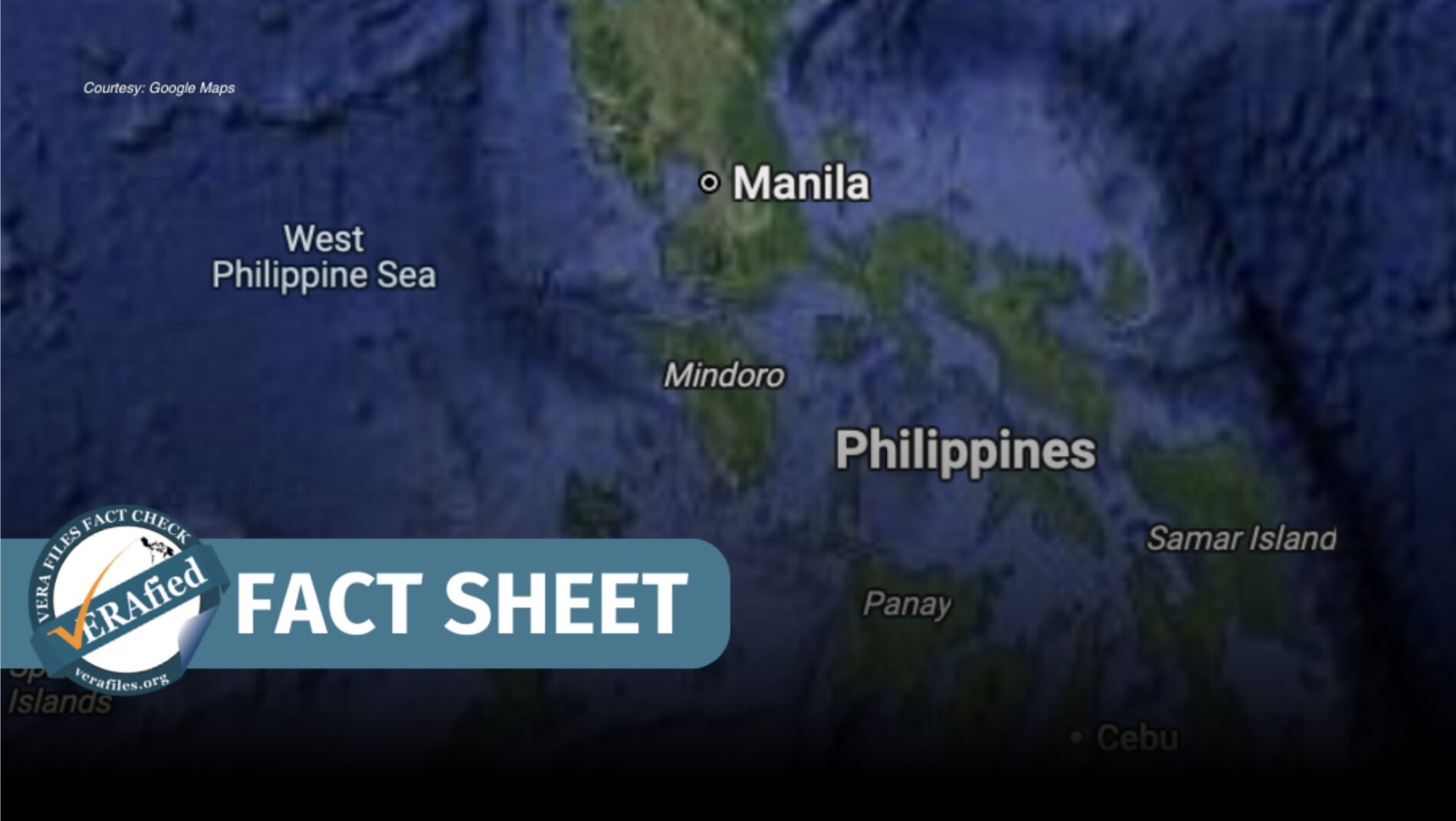

News outlets and netizens noted on April 14 that Google Maps had more prominently labeled and displayed the West Philippine Sea (WPS) on its site.
Malacañang praised the move amid the Philippines’ ongoing maritime and territorial disputes with China in the WPS. “Ipinagpupunyagi po natin [ito] dahil isa itong pagkilala na ang West Philippine Sea ay sa atin,” Presidential Communications Office Undersecretary Claire Castro said in a Palace briefing.
(We celebrate this [development] because this signals recognition that the West Philippine Sea is ours.)
The National Maritime Council also praised the label as a “reflection of the growing acceptance that the waters of the West Philippine Sea are within our sovereignty, sovereign rights and jurisdiction.”
VERA Files explains:
Does Google Maps officially recognize the WPS?
Google said in a statement on April 16 that the WPS “has always been labeled” on the platform. “We recently made this label easier to see at additional zoom levels,” a spokesperson clarified.
Google Maps said in its Help Center that disputed land territories are “displayed in different styles according to the political status of the border.”
The WPS is also labeled on Google Earth with the official description:
“West Philippine Sea is the designation by the government of the Philippines to the parts of the South China Sea that are included in the country’s exclusive economic zone (EEZ). The term is also sometimes incorrectly used to refer to the entire South China Sea.”
Does this mean that the WPS is now recognized by the international community?
In terms of jurisdiction, a number of countries and international bodies have formally acknowledged the Philippines’ claims on territories in the WPS.
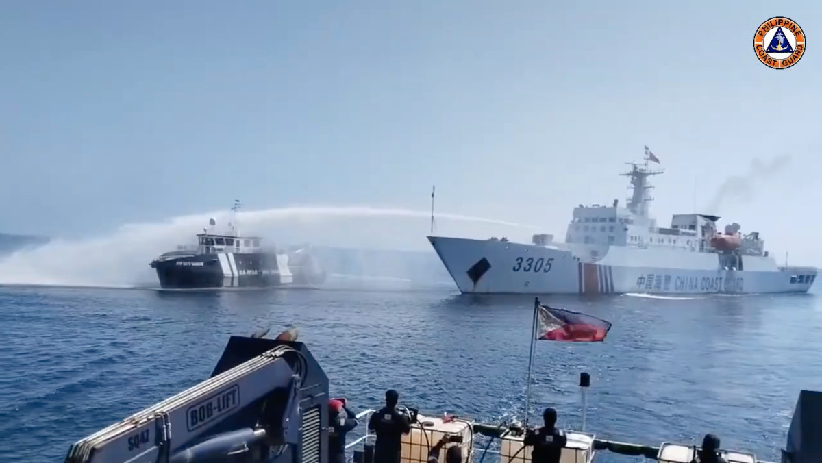
In 2016, the Permanent Court of Arbitration affirmed that the Philippines enjoys sovereign rights over several features in the South China Sea. The Court also noted that China violated these rights by constructing outposts and by restricting the Philippines’ access to these territories.
In particular, the Court issued the following key decisions in its arbitral award:
- China has no legal rights in the entire South China Sea based on its “historical claims.”
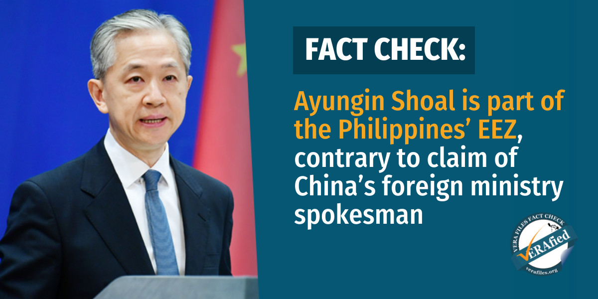
- The Philippines is entitled to an EEZ spanning Mischief Reef (Panganiban Reef), Second Thomas Shoal (Ayungin Shoal) and Reed Bank (Recto Bank).
- China violated shared traditional fishing rights by blocking the Philippines’ access to Scarborough Shoal.
- China violated obligations to protect the marine environment with its construction of land reclamation projects in several features of the South China Sea.
Under the United Nations Convention on the Law of the Sea, states are entitled to an EEZ spanning 200 nautical miles “from the baselines from which the breadth of the territorial sea is measured.”
However, international organizations have yet to label the West Philippine Sea in maps or recognize it as a geographical entity.
Administrative Order (A.O.) No, 29, issued by former president Benigno Aquino III in 2012, instructed relevant government agencies on mapping and foreign affairs to submit an official map containing the WPS to international organizations such as the United Nations (UN), the International Hydrographic Organization and the UN Conference on the Standardization of Geographical Names.
No public records show that the Philippines has submitted any such document to the above organizations. VERA Files has reached out to members of the National Task Force for the West Philippine Sea for comment but has not received a reply as of 7 p.m. of April 26.
Although no official moves have been made for international recognition of the WPS name, the government submitted documents to the UN Commission on the Limits of the Continental Shelf on June 15, 2024 to extend the country’s continental shelf, or geographical boundary. The Philippine Mission to the UN requested an extended boundary in the West Palawan region of the WPS.
The Department of Foreign Affairs said that the government’s designated technical working group worked on the submission for a decade and a half.
Quick Review: How did the WPS come into existence?
A.O. No. 29 officially named the West Philippine Sea covering “the Luzon Sea as well as the waters around, within and adjacent to the Kalayaan Island Group and Bajo de Masinloc, also known as Scarborough Shoal.”
The same definition of the WPS is also carried in Republic Act No. 12064 or the Philippine Maritime Zones Act, which was signed on Nov. 7, 2024.
The WPS only refers to the EEZ of the Philippines and not the entire South China Sea.
The 2016 arbitral award, which China does not recognize, affirmed that the Philippines enjoys sovereign rights over specific territories in the WPS. The country’s claim on other land features in the area remains contested due to overlapping jurisdiction with other states.